Harrison Lake Lookout
Distance: 14 km
Elevation gain: 924 m
Difficulty Level: Intermediate (or hard if you are not used to wild and unmaintained trail)
There is a tiny parking lot next to the trail head. It can park three to four cars the most. But if it’s full, there is an apartment with plentiful parking next to the trail head. But from what I can see on the day I hiked, this trail was not that busy even during a weekend therefore you should be able to park right at the trail head.
There is a locked metal gate blocking the trail/service road. You can easily walk around the gate.
The most important thing before you hike this trail is to download an offline map. The trail lacks maintenance. There are blowdowns everywhere. The bridges, ladders and balance beam (yes there is a balance beam) have seen better days and look sketchy. Trail markers are spotty. There are weird switch back and wrap-around. My cell lost signal at some spots. All in all, it’s a good idea to have an offline trail map.
I am not trying to describe turn-by-turn because I was focus on following the trail. I looked at my cell phone very often. Even that, I was making the wrong turn a couple times.
The first view point is called “Mountain View”. Not much view at that point other than a power tower and a very ordinary mountain.
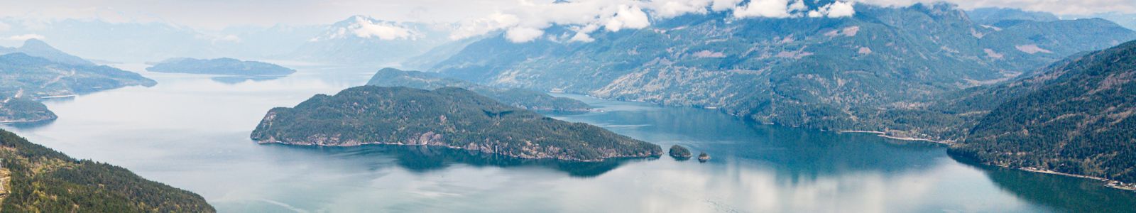
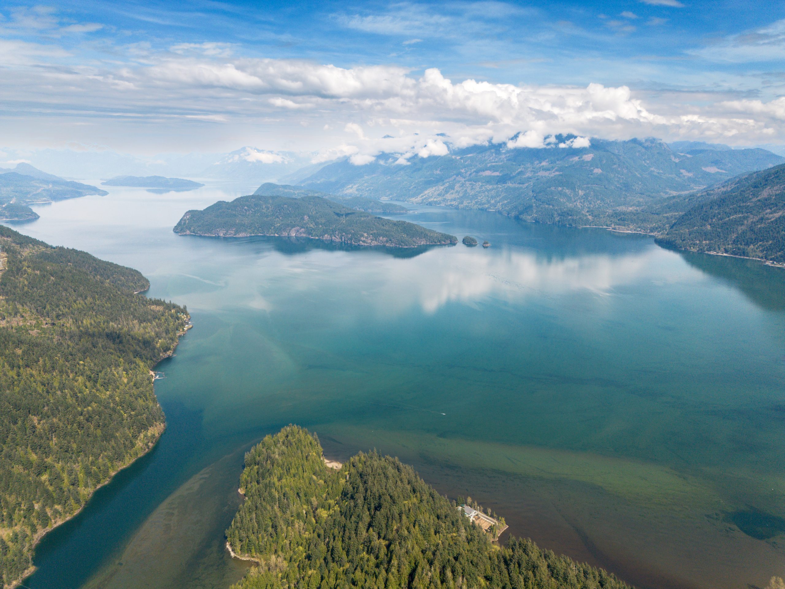
After some more ascending, you come to the second lookout which is a slight detour (20 meters) from the main trail. It’s easy to miss the lookout if you don’t look at the map. At the look out, you can see Harrison Lake and surrounding mountains. Some hikers turn around at this point because they have seen the lake. But I encourage you to continue to the last view point because the most ascending has been done. The rest of the trail is pretty mellow but still with a bit distance.
After some trail finding and ducking under down trees (or crossing over them), you come to a beautiful lake with reflection of trees on a calm day. The lake is called Campbell Lake. After taking a rest, you can continue to the final lookout.
After Campbell Lake, you are hiking on some forest logging roads. You will see tire marks, cut trees and very wide service roads. Again, look at you offline trail map to make sure you are on the right trail. There are no trail markers what so ever in this part. The forest logging roads are forking left and right.
Not for long you will arrive to an obvious spot with flat area and pretty open to the view of Harrison Lake. You have found the last lookout of this trail (the ultimate look out).
After you have enjoyed the view and taken a good rest, just follow the same trail to go back to the parking lot. Again make sure you check your offline map to prevent a wrong turn. even though the mountains in this part is pretty mellow with no big drop, but a wrong turn can cause unnecessary frustration and spending energy.


